River Sins Every Mapmaker Should Know
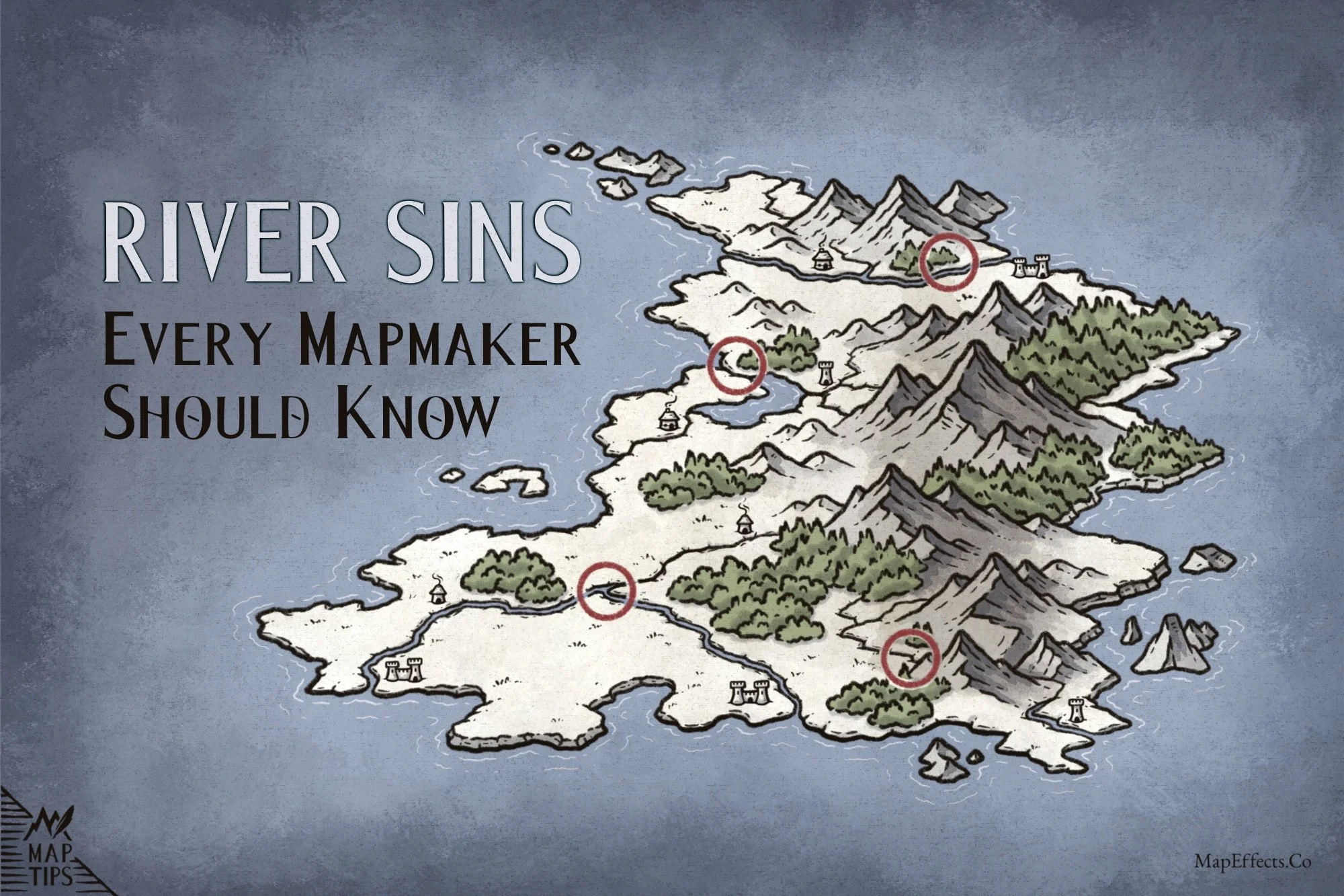
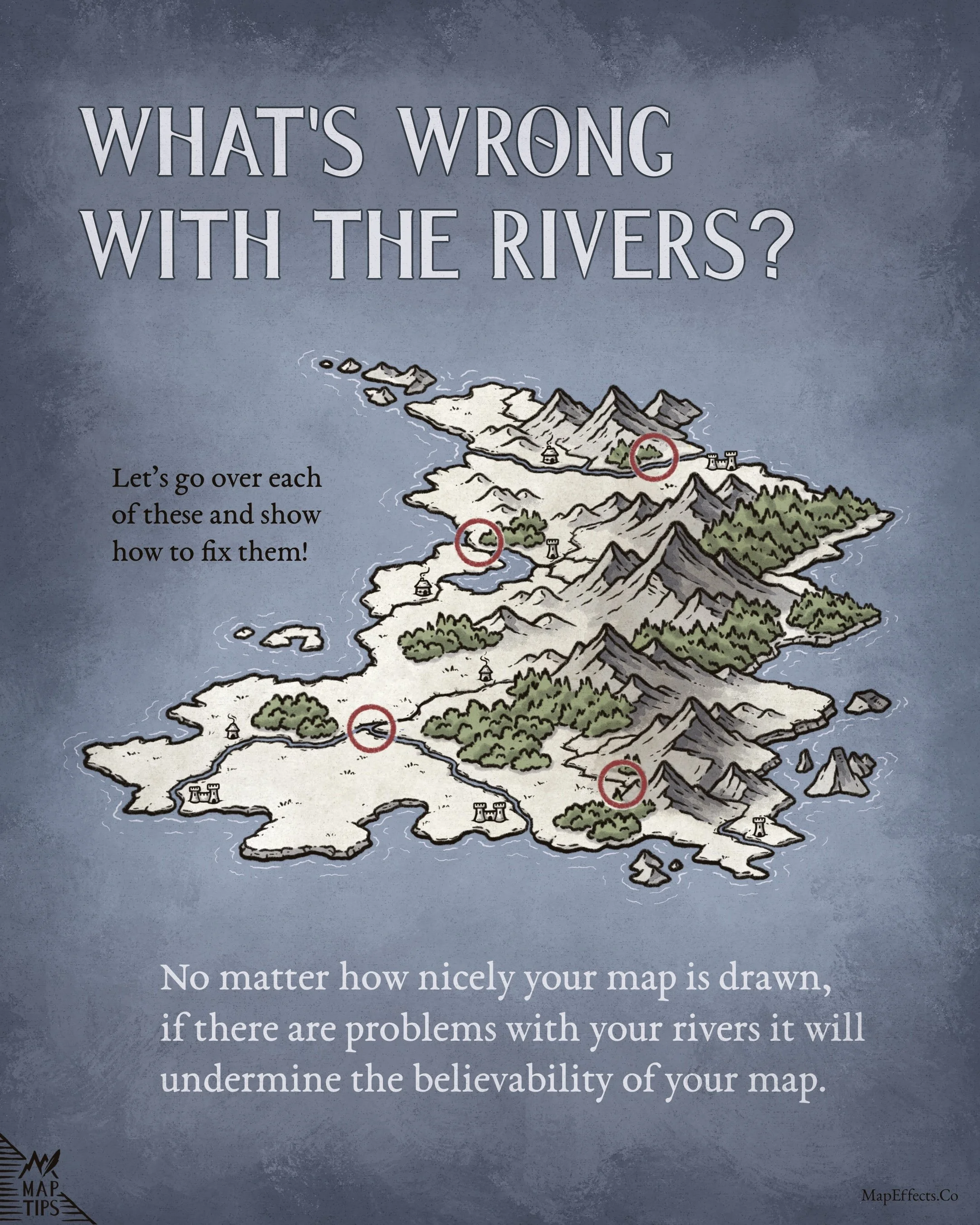
What’s Wrong with this Map?
One of the interesting things about fantasy maps is that a map can be artistically beautiful and still feel subtly “off.” Often, the issue has nothing to do with the artist’s skills in rendering, but with how natural systems like rivers behave across the landscape.
Rivers are one of the easiest ways to accidentally undermine the believability of a world because our brains instinctively recognize when water flow doesn’t make sense, even if we can’t immediately explain why.
So let’s take a look at some of the most common river mistakes fantasy mapmakers make and how to fix them.
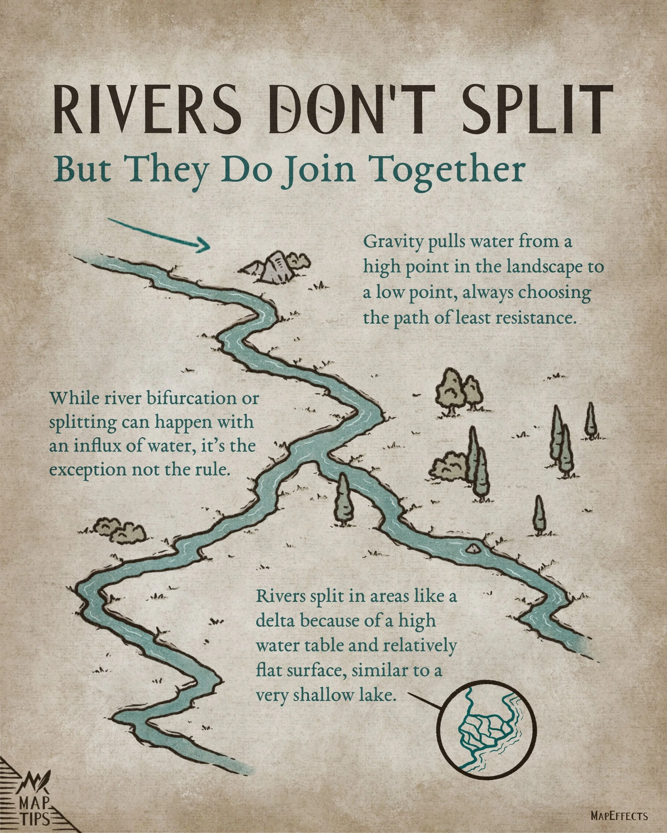
Rivers Don’t Split - They Join Together
If you’ve been drawing fantasy maps for any length of time and sharing your work online, sooner or later you’ll encounter a member of the what we jokingly refer to as the “river police.” And one of the first things they’ll point out is that rivers don’t split!
Now to be fair, river bifurcation absolutely can happen. Flooding, deltas, marshes, or extremely flat terrain can sometimes cause a river to branch apart temporarily. Plus, there actually are a few famous real-world examples, such as the “Parting of the Waters” in Wyoming, where a creek splits and eventually drains toward both the Pacific and Atlantic oceans.
But the reason places like this are famous is precisely because they’re unusual! In most landscapes, rivers naturally merge together into larger waterways as gravity pulls water downhill along the path of least resistance.
So this isn’t to say splitting rivers can never happen in fantasy worldbuilding. But unless you’re doing it intentionally for a specific geographic or story reason, it’s usually best to avoid.
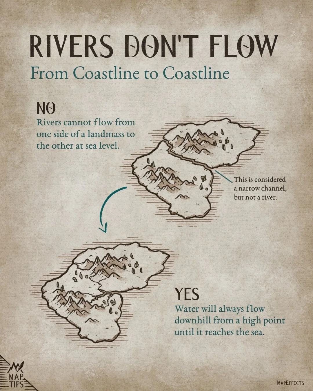
Rivers Don’t Flow From Coastline to Coastline
One of the easiest ways to unintentionally make a fantasy map feel less believable is by drawing rivers as though they connect two coastlines at sea level. In reality, rivers are shaped by elevation and gravity. They begin at high points such as mountains or hills and flow downhill until they eventually reach the sea.
There are exceptions, like narrow sea channels, canals, or unusual geological formations, which can sometimes resemble waterways cutting across a landmass…especially when viewed from ground level! But unless there is a specific reason for it in your setting, rivers generally flow toward the nearest sea rather than from coastline to coastline.
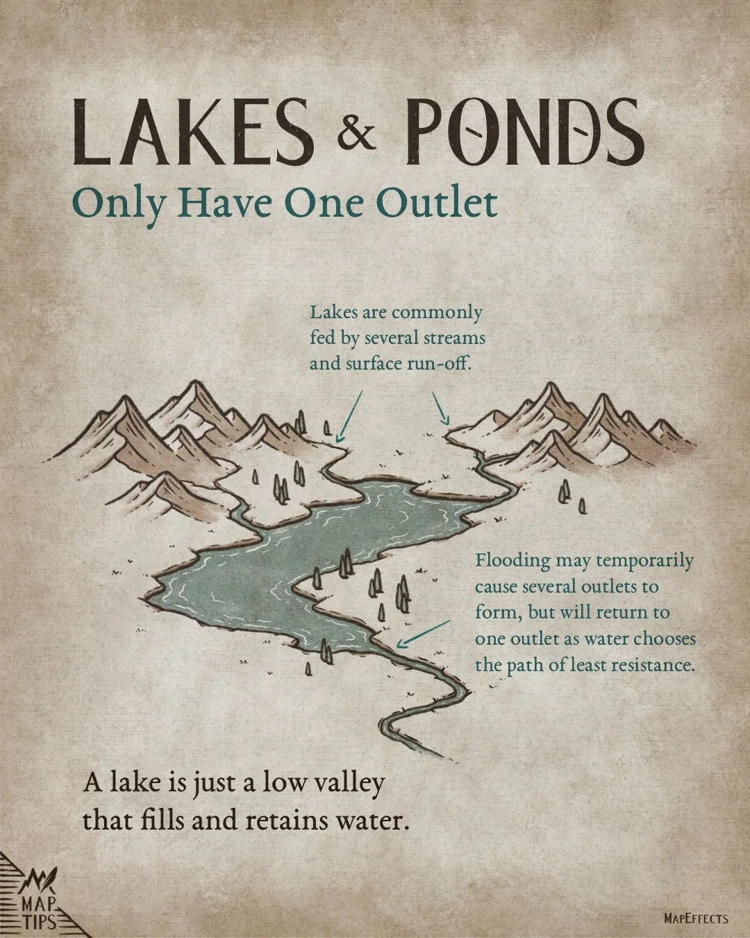
Lakes & Ponds Only Have One Outlet
One helpful way to think about lakes is that they are essentially low areas in the landscape that collect and retain water. Because of this, lakes are often fed by multiple streams, rainfall, snowmelt, and surface runoff flowing downhill from the surrounding terrain.
Eventually, the water needs to go somewhere as it fills. In most cases, gravity causes the lake to drain through a single primary outlet where the water finds the easiest path downhill.
There are exceptions, of course. Flooding, wetlands, or extremely flat terrain can sometimes create temporary secondary outlets or branching waterways. But unless there is a specific geographic reason in your setting, lakes and ponds will usually drain through one dominant exit point.
More Tutorials You May Enjoy


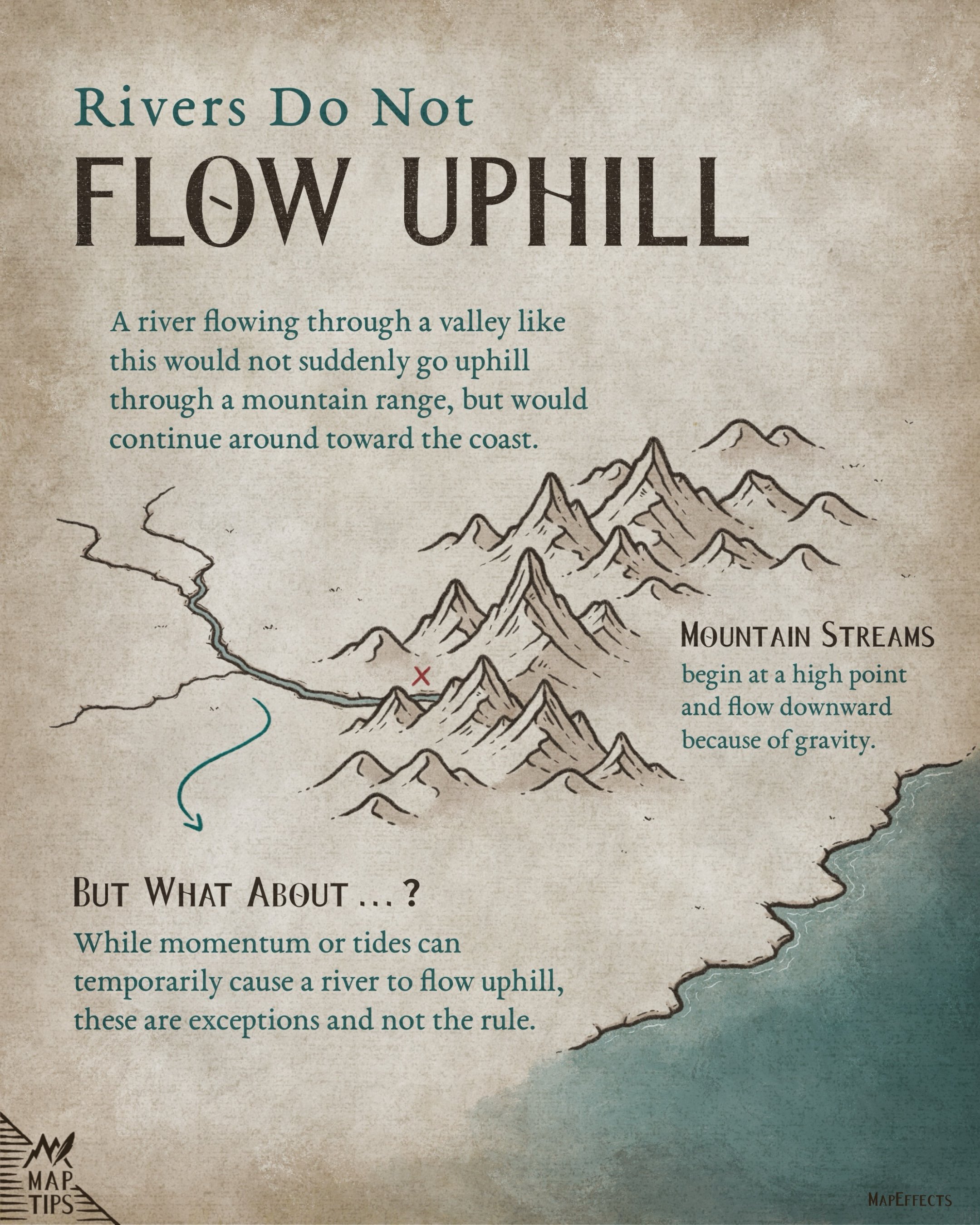
Rivers Do Not Flow Uphill
This may seem like an obvious one, but you’d be surprised how easily it can creep into fantasy maps, especially when drawing rivers near mountain ranges.
The issue usually happens when a river is drawn flowing through a valley and then suddenly turns uphill into the mountains rather than continuing downhill toward the coast. While mountain streams absolutely exist, they begin at high elevations and flow downward as gravity pulls water toward lower ground.
Of course, fantasy worlds can always contain unusual geography, magical forces, or ancient engineering that changes how rivers behave. But unless you’re intentionally creating a special feature for your setting, it’s generally best to let rivers follow the natural slope of the land.
Learn How to Draw Rivers on Your Maps
If you want to learn how to put pen to paper and draw some rivers on your fantasy maps, check out this tutorial!