
The Odyssey | Mapping the Great Adventure Home
Over the years I’ve begun the habit of drawing the map of whatever story I’m reading. It’s a tactile way for me to engage the world of a story that goes beyond simply reading words on a page. When you draw it, you have to slow down. You have to ask where things are, how far apart features might be, what the terrain would look like, and how the characters may interact with the landscape.
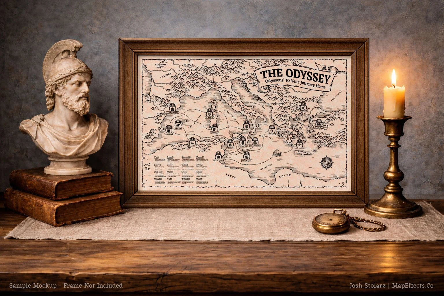
When it came to Homer’s Odyssey, I knew it would be a perfect candidate for this kind of treatment. The entire epic is an adventure through storms, mysterious islands, treacherous straits, and of course, all while encountering monsters along the way. If any story begs to be mapped, it’s this one. And if I’m honest, part of the reason I wanted to draw it was personal and came from a desire to become better acquainted with one of the pillars of literature in Western Civilization. I remember reading sections of The Odyssey in school, but knew I’d never read it cover to cover. I chose Robert Fagles’ translation because it felt like a good balance between poetic readability and scholarly accuracy, without making it feel so archaic that I would struggle to make it through the book.
As I read, pencil in hand, I began sketching.
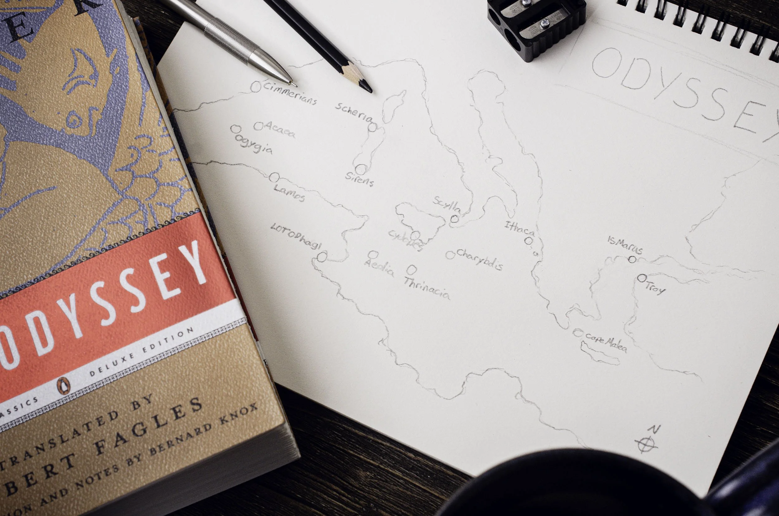
The first real problem I ran into was the route itself. Very quickly I discovered that there is no clear scholarly consensus on where Odysseus actually traveled and how much of it is pure myth while still being grounded in a historical time and place. Is Scylla and Charybdis best identified with the Strait of Messina? Where should Aeaea, the island of Circe, be placed…along the Italian coast, or farther west? And what about Ogygia, Calypso’s island…should it be in Malta or the distant western sea? Some reconstructions keep the journey largely within the eastern and central Mediterranean, while others push key episodes nearly to the Pillars of Hercules in the west. The debate stretches back centuries, and I quickly realized that while I love history, I’m not primarily a scholar, and I wasn’t going to be the one who cracks the code sitting in my yurt with my cup of coffee. Besides, that wasn’t my goal. At some point, I had to accept that I would just have to choose a route that aligned best in my mind with the internal details of the story and start drawing.
I know not everyone will agree, and that’s okay. I don’t think Homer’s goal was to create a navigational document that future readers could overlay precisely onto modern coordinates. Trying to force a one-to-one match between myth and modern geography would miss the point. I recognize there is irony in saying that while actively creating a map of the journey, but what I found myself building was less a strict reconstruction and more a geographical story timeline. A way to give the imagination structure without pretending to eliminate mystery.
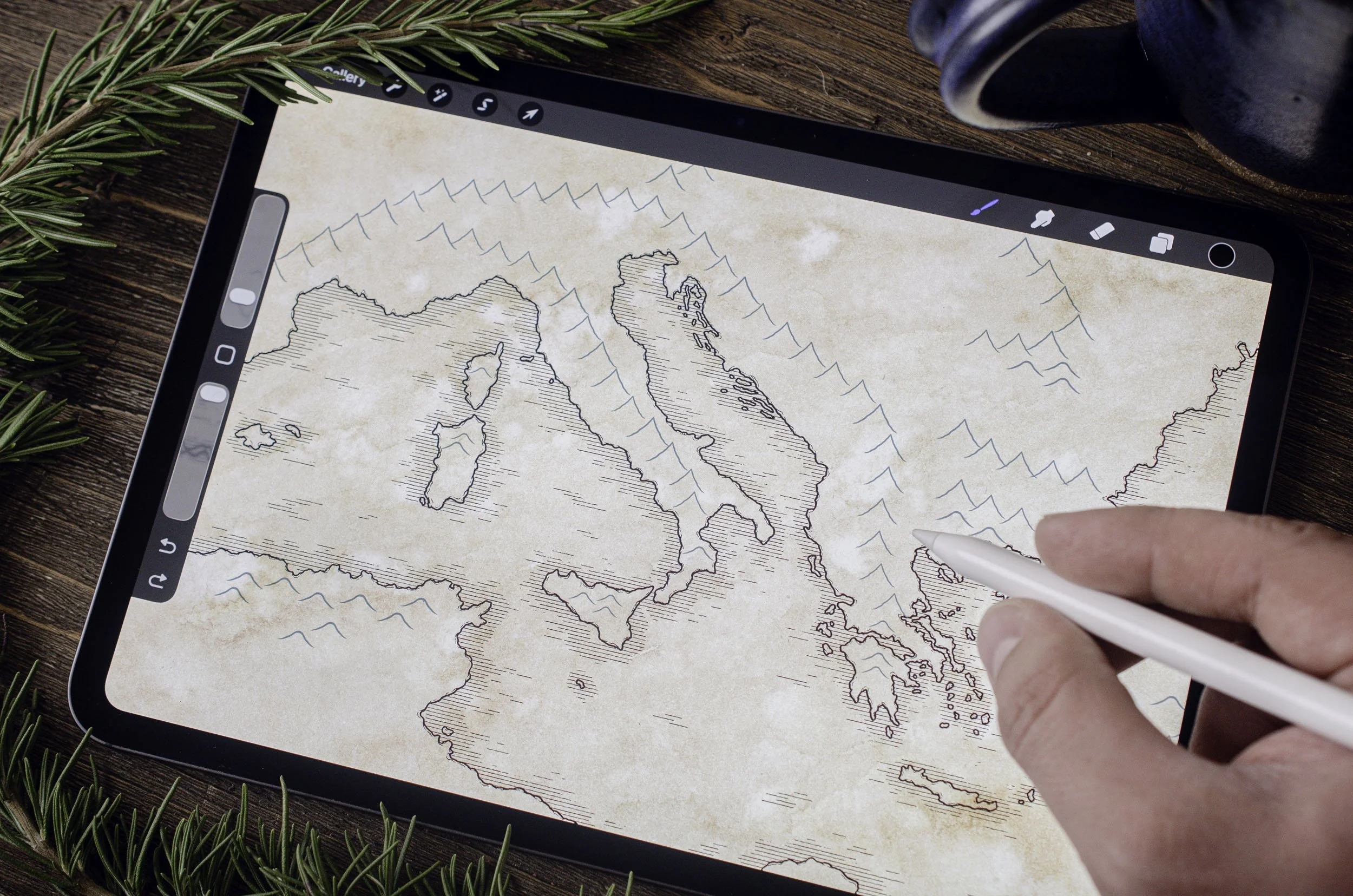
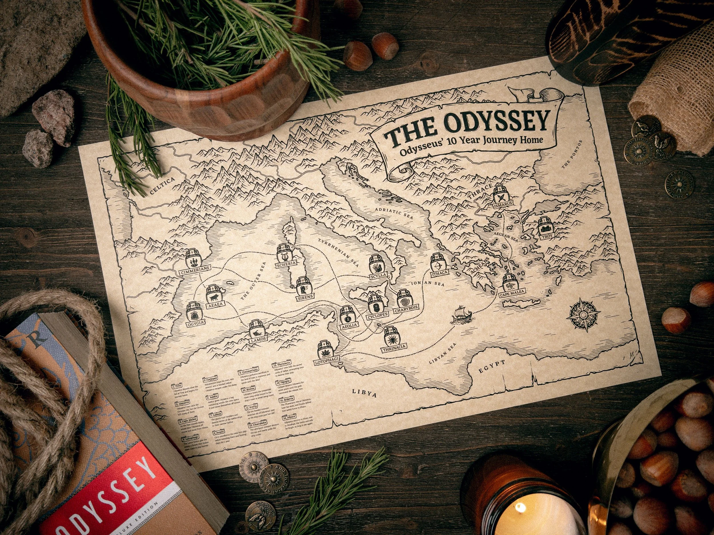
When it comes to drawing maps, the first step is a rough coastline. Before icons, labels, or even mountains, I wanted to just see land and sea. I needed to see where this was all taking place. While I drew mountain ranges and interior terrain later to give the map depth and a sense of place, I kept reminding myself that this is primarily an island and coastal story. Odysseus isn’t marching deep into forests or crossing vast inland plains. He’s sailing, drifting, being blown off course, hopping from island to island like moving between episodes in a narrative timeline. The sea is the connective tissue of the epic. That realization shaped the composition. The spacing between islands the straits, and the open water all mattered. The interior landscape exists, but it does not dominate, because the story itself lives along the edges.
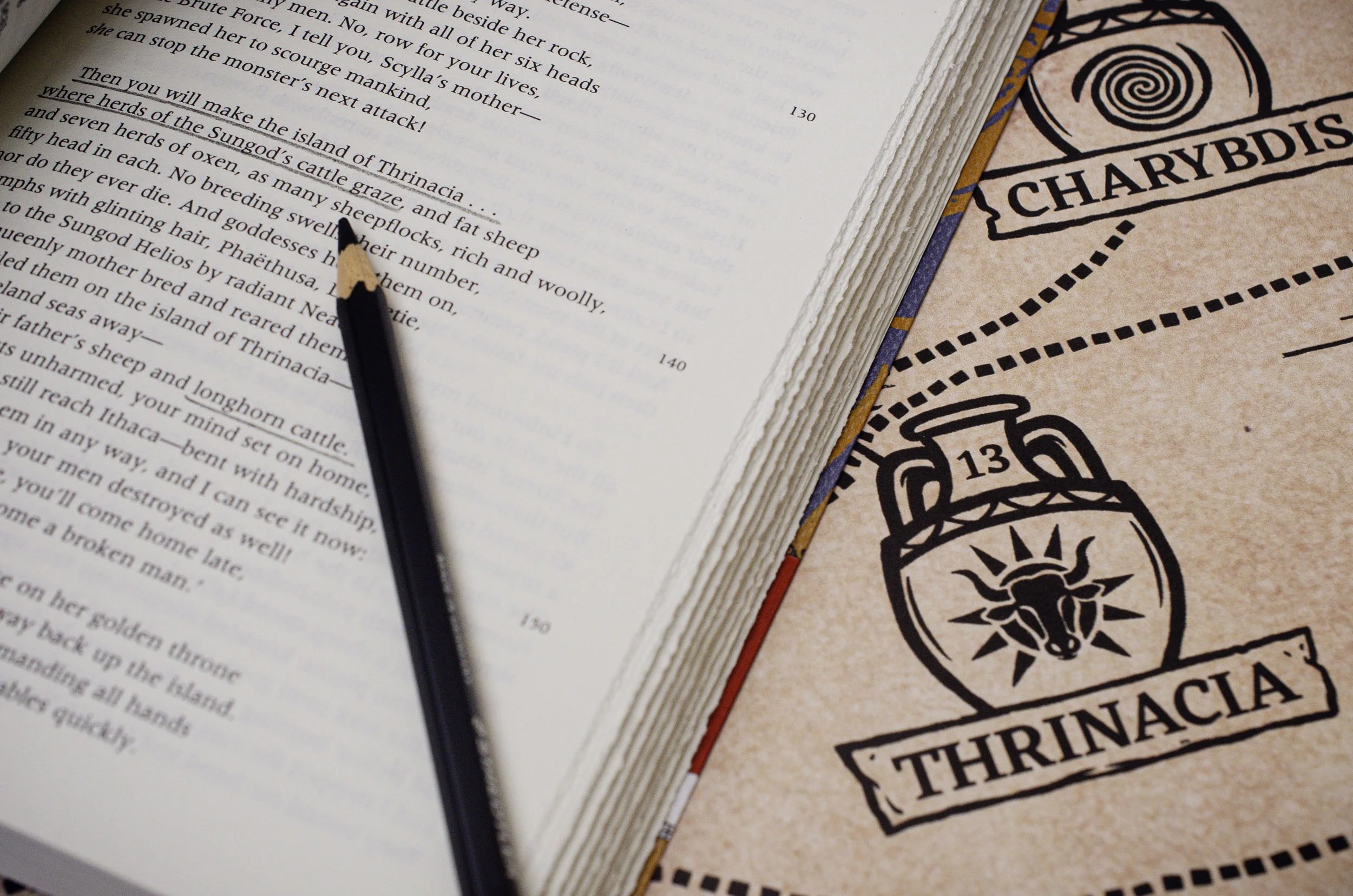
Once I had the basic geography and an idea for the route, I knew I wanted the icons to drive the visual story of the map. I wanted the icons to echo classical black-figure pottery found in Ancient Greek culture, something graphic but not overly cartoonish. Each location needed to visually capture the essence of the event; the Cyclops had to be instantly recognizable while the design for the Chimmerians needed to feel mysterious. The goal was that someone could glance at an icon and immediately recall what happened there. They function as narrative anchors and a timeline. This step is definitely what took the longest and I sketched multiple versions of all of them before settling on designs that felt balanced. Too much detail and they looked visually muddy, while too little felt simplistic.
As I mapped the journey, I also began listening to some podcasts talking about Homer’s epics. One thing I found fascinating is that different eras seem to gravitate toward either the Iliad or the Odyssey depending on the cultural moment. The Iliad is a story of battlefield glory and the pursuit of honor. During the Victorian period, when there was cultural optimism about progress and expansion, it was the Iliad that captured the imagination. But in recent decades, if you look at scholarly and student engagement, there has been significant emphasis on the Odyssey, which feels telling. The Odyssey is not a story of conquest but of wandering. Of being blown off course. Of longing for rootedness while being tossed around the wine-dark sea, wondering if you will ever see your wife and son again. That resonates in a world that often feels chaotic.
There are easier subjects to draw. But the Odyssey has endured for nearly three thousand years for a reason. It shaped education, literature, and imagination. Drawing this map was my way of engaging one of those foundations and adding my creative voice to a long line of artists who have been inspired by this epic. If this map causes someone to reopen Homer, to think introspectively about the journey, or simply to trace the route with their finger and feel inspired b the road home, then it has done what I hoped.